Mount Fuji (富士山 pronounced Fuji-San)
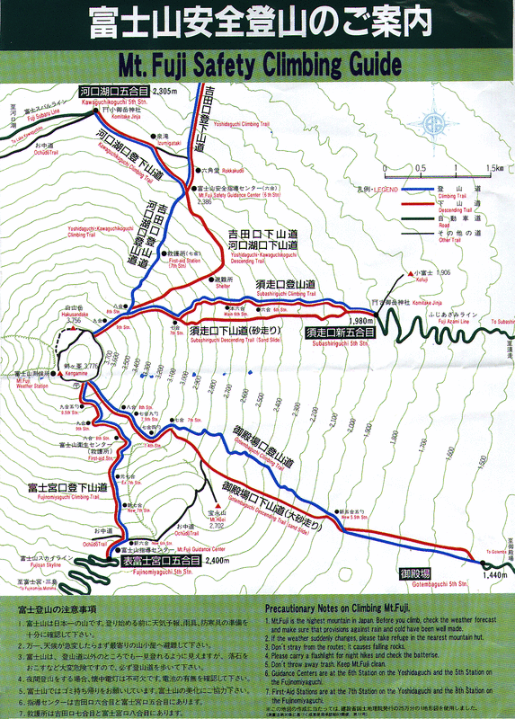
The tallest mountain in Japan, memorialized in Japanese art, music, and folklore for thousands of years, Mount Fuji is a challenging hike that will make for a once in a lifetime experience. There is ample information elsewhere about planning a hike so I will not detail everything you need to know here, but below are maps of the most popular trails. Note that the minimum elevation you will be climbing is over 1400 meters, or the equivalent of climbing to Kintai Castle 7 times in a row. Mount Fuji Wiki
The zoomable map from my gpx files includes the yoshida trail from town (station 1), the kawaguchiko trail, gotemba trail, and the fujinomiya trail.
Click here to get this GPS map on your iphone
The zoomable map from my gpx files includes the yoshida trail from town (station 1), the kawaguchiko trail, gotemba trail, and the fujinomiya trail.
Click here to get this GPS map on your iphone
This map was created using GPS Visualizer's do-it-yourself geographic utilities.
Please wait while the map data loads...
